Network Center for Earthquake, Tsunami and Volcano
Operation of an observation network for earthquakes, tsunamis and volcanoes to monitor what is happening every moment across the country
Bracing for natural disasters such as earthquakes, tsunamis and volcanic eruptions starts with being able to accurately grasp the current picture of that hazard, which relies heavily upon high-quality observation data. Monitoring of Waves on Land and Seafloor (MOWLAS) is an integrated land and sea observation network for earthquakes, tsunamis and volcanoes covering all land and sea in Japan, in order to not miss any data for an event that occurs anywhere in Japan, and which is capable of providing precise data without delay. Since the integrated operation began in November 2017, MOWLAS has continued to cast an attentive eye over the entire land, contributing to mitigating disasters caused by earthquakes, tsunamis and volcanoes.
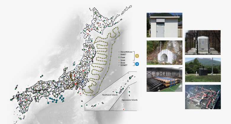
Encompassing All Japan
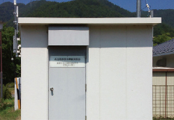
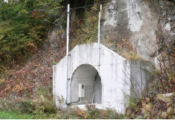
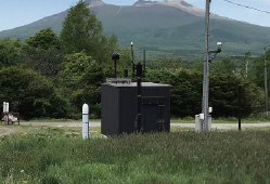
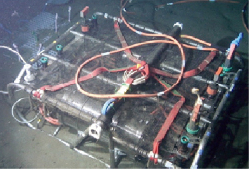
A total of 2,100 observation stations are embedded in the land and sea across the Japanese archipelago. Various seismometers detect the different kinds of shaking on land, while in the sea there are both seismometers and water pressure gauges for measuring earthquakes and tsunamis.
-
Micro-earthquake
Hi-net(High Sensitivity Seismograph Network Japan)
-
Strong motion
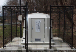
K-NET(Kyoshin Network)
KiK-net(Kiban Kyoshin Network) -
Ground motions in broad frequency range
F-net(Full Range Seismograph Network of Japan)
-
Volcano
V-net(The Fundamental Volcano Observation Network)
-
Ocean area from off the coast of Hokkaido to Boso Peninsula
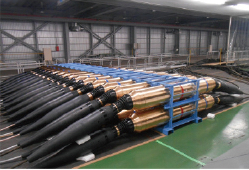
S-net(Seafloor observation network for earthquakes and tsunamis along the Japan Trench)
-
Ocean area from off the coast of the Kii Peninsula to Cape Muroto
DONET(Dense Oceanfloor Network system for Earthquakes and Tsunamis)
Grasping in real-time
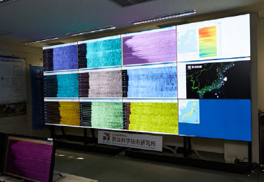
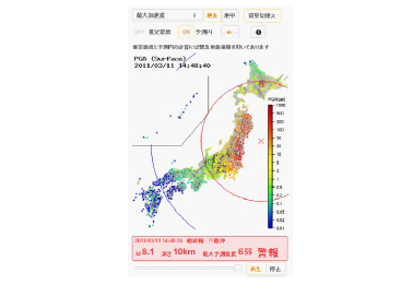
Grasping the actual condition of hazards in real-time through MOWLAS helps to conduct appropriate disaster response measures. In addition to being aggregated at the data center, observation data are widely publicized and shared through our website, where they can be accessed by anyone. One example of this is “Kyoshin Monitor” (strong motion monitor) which visualizes and live broadcasts all seismic activity in the Japanese archipelago.
-
Seismic data observed by MOWLAS
-
Utilizing observation data to realize a society with a higher level of resilience to disasters.
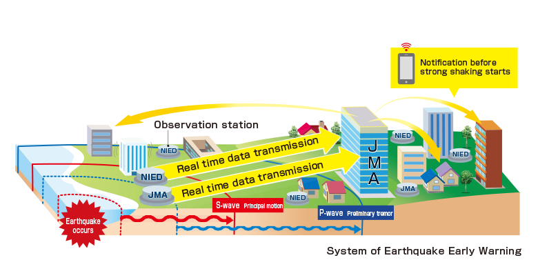
Observation data and the technologies that use them are applied in several areas of society. An example of this is the technology co-developed by NIED and JMA, which is used in JMA’s earthquake early warnings. In fact, NIED provides as much as 80% of the data used for these early warnings. Land and sea observation data provided by MOWLAS are also used for disaster preparedness countermeasures such as emergency stops on the Shinkansen (bullet train).
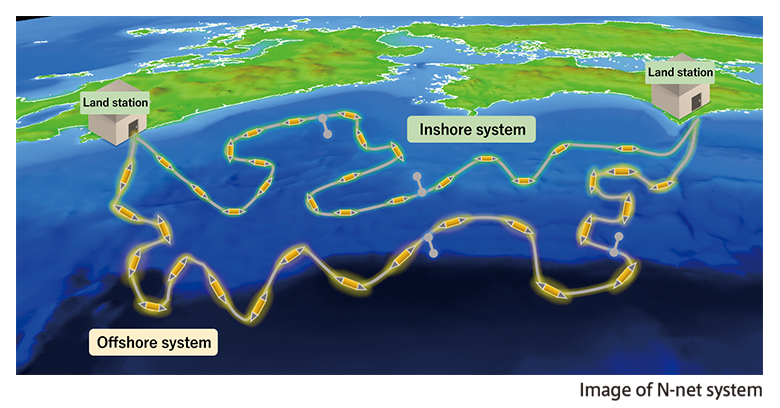
Deployment of Nankai Trough Seafloor Observation Network for Earthquakes and Tsunamis (N-net)
There is currently no observation network in the ocean area from off Cape Muroto (Kochi Prefecture) to Hyuga-nada (Miyazaki Prefecture) within the seismic source region of the anticipated Nankai Trough Earthquake. We are now preparing the deployment of a large-scale seafloor observation network to observe earthquakes and tsunamis in real-time in this area.
Utilization of Data for Earthquakes, Tsunamis and Volcanoes to Mitigate Damage by Accurately Obtaining the Data
Director-General AOI, ShinJapan is a country that is constantly threatened by disasters and almost peerless globally. By obtaining real-time data through the large-scale and high-density observation network that is peerless globally in terms of scale, we aim to mitigate damage by swiftly grasping the circumstances of a disaster and responding immediately. We also can contribute to a legacy of disaster preparedness by passing on accurate disaster data to future generations. As a core organization for measuring earthquakes, tsunamis and volcanoes, we will work toward advancing foundational investigative research regarding these threats, while also promoting research and development for observing and predicting disasters.