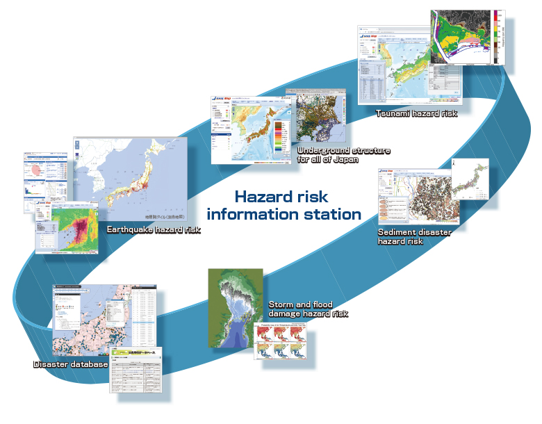
Research regarding hazard risk assessment
Disseminating Hazard Risk Information Based on Scientific Insight
Hanshin/Awaji Earthquake disaster and the Great East Japan Earthquake disaster underlined the need for earthquake and hazard risk evaluation for the whole country. By applying our wealth of knowledge and the latest simulation technologies to the fullest extent, we will transmit hazard risk information for various types of natural disasters. Through the usage and application of this information, we aim to realize a more resilient nation. Currently, we are promoting R&D and transmitting information with the whole of Japan in our scope, centered on developing hazard information stations such as “J-SHIS”, as well as leveraging technologies for real-time damage estimation.
Earthquake hazard station “J-SHIS”
J-SHIS was established to help prevent and prepare for earthquake disaster by providing a public portal for seismic hazard information across Japan.
J-SHIS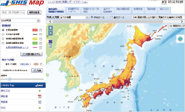
Contributing to formulate maps for predicting earthquake motion
Focused on evaluating seismic hazards, we develop methods for predicting seismic shaking and maintain databases for the entire Japan. These are also used for the creation of seismic motion prediction maps that are publicized by the Headquarters for Earthquake Research Promotion. As well as general release through J-SHIS, research results are also utilized for calculating earthquake insurance standard rates.
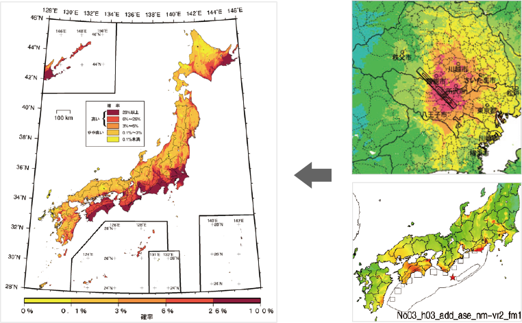
Probability of experiencing shaking of at least intensity 6 (lower) in the next 30 years (average case/all earthquakes/2018 version)
Promoting tsunami hazard evaluation for the entire Japan
-
Since the Great East Japan Earthquake disaster of 2011, we have conducted research into the hazard risk posed by tsunamis for the entire Japan. Currently, we are focused on tsunami hazard evaluation based on simulations and databases.
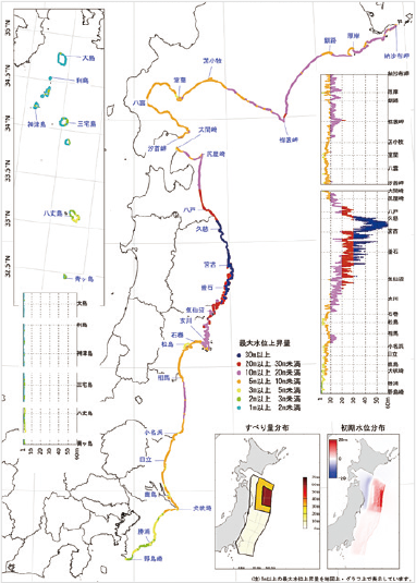 Map predicting maximum height of tsunami triggered by earthquake and expected water level.
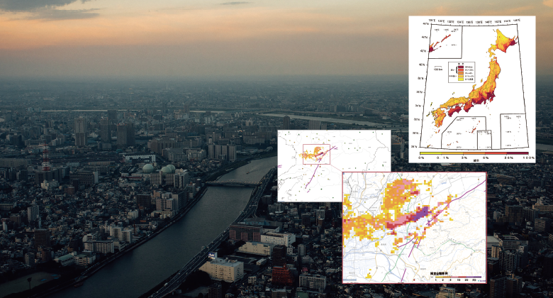
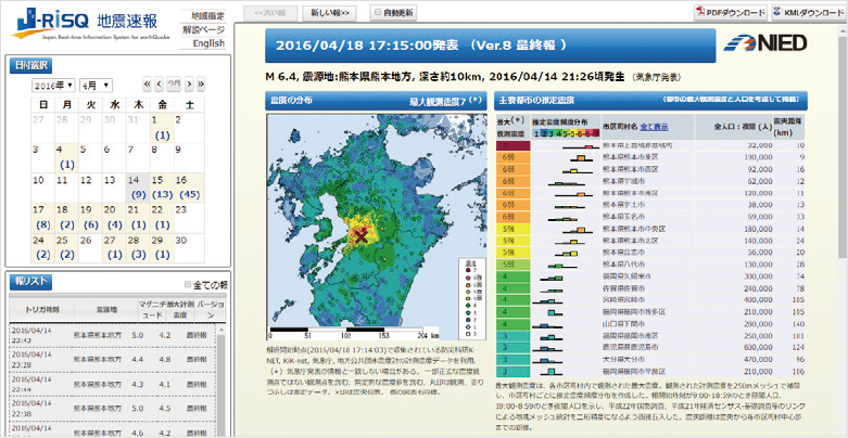
Real-time estimation of seismic intensity surface distribution and extent of the damage
Through analyzing a vast amount of earthquake observation data for all Japan including that provided by MOWLAS, we can estimate seismic intensity distribution in real-time for an entire area. In around 10 minutes, it is possible to concretely estimate the extent of damage such as the number of completely destroyed buildings. Part of this is made public as “J-RISQ” earthquake early warnings.
-
 Surface distribution of seismic intensities at time of maximum foreshock during 2016 Kumamoto Earthquake (J-RISQ)
 -
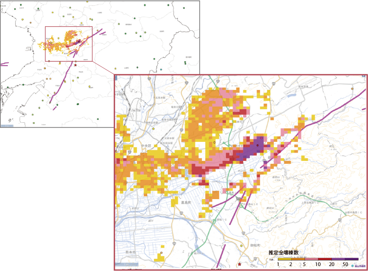 (top-left) Results of real-time damage estimation at time of maximum foreshock during 2016 Kumamoto Earthquake (Estimated distribution of completely collapsed buildings ) (bottom-right) Enlarged map of Mashiki town and vicinity where damage was significant.
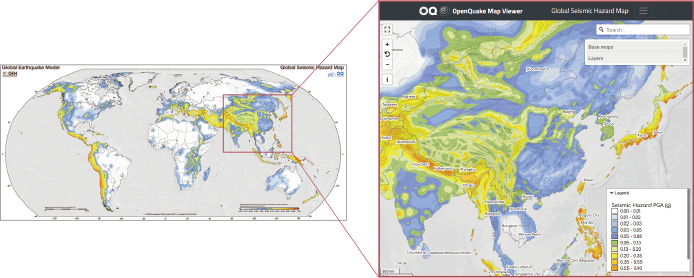
TOPICSContributing to global earthquake hazard risk maps
GEM (Global Earthquake Model) aims to evaluate earthquake hazard risk all around the world using an internationally standardized protocol. As an organization representing Japan, NIED has shared its own research findings while taking on a coordinating role for the Asia region. A decade later, the global hazard risk map is complete and can be accessed through maps.openquake.org