Research on combining risk monitoring and forecasting technologies for mitigation of increasingly diverse snow disaster
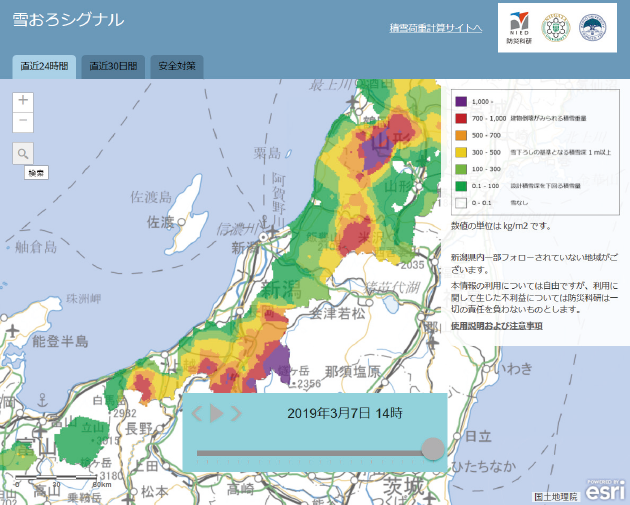
Visualizing Degree of Risk for all Snow and Ice Disasters in Real-time!
Traditionally, snow and ice disasters occurred in heavy snow area on the Sea of Japan side. However, recently, serious damage has occurred in the Pacific Ocean side where snow doesn’t fall often and the heavily populated areas in the Tokyo Metropolitan area. Although snow and ice disasters have been statistically predicted based on weather and wind speed, this project is developing a new prediction system using the laws of physics. For example, how much will the snow melt under certain temperatures and wind speeds (m/sec). Through numeric calculations based on fundamental laws for each individual process, we are aiming to enhance the precision of predictions.
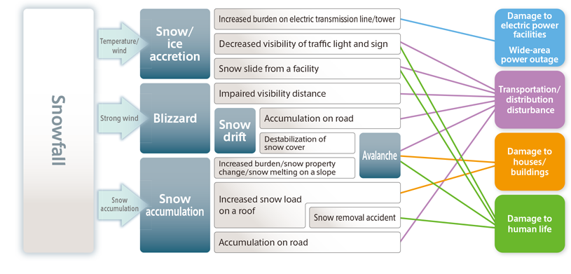
Snow and ice disaster event tree
Snow and ice disasters cause the damage to human life, collapse of buildings, electric outage, as well as impacting on transportation and distribution systems depending on where they occur and the type of hazard (blizzard, avalanche, snow/ice accretion etc.). This project conducts research in all types of snow and ice disasters.
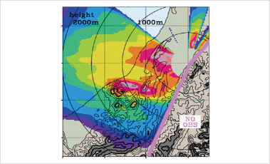
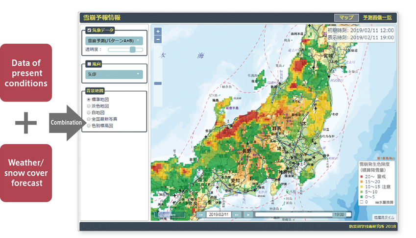
Real-time prediction for snow and ice disasters
By combining observation data of current conditions with technologies for predicting the weather/snow accumulation, we create comprehensive real-time hazard maps for snow and ice disasters, encompassing avalanches, blizzards and snow accretion. These are also used for managing the roads and transport infrastructure. In future, in addition to deployment on the Japan Sea side of Japan which experiences a lot of snow, this will be extended to the Pacific Ocean side and Tokyo Metropolitan region where south coast low-pressure systems regularly cause heavy snow and serious damage. In doing so, we aim to effectively respond to increasingly diverse snow and ice disasters.
Recreating the shape of snow!
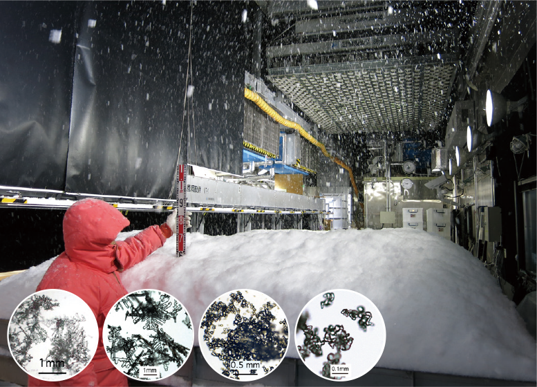
World’s lone experimental facility “Cryospheric Environment Simulator”
Cyrospheric Environment Simulator (CES) is the only experimental facility in the world that is capable of simulating snow with near natural crystal shape. In recent years, it has become apparent that the likelihood of surface avalanches changes depending on the type of snow such as large snowflakes that are formed by the crystals in small branch-like snow becoming aggregated and hails with round ball-like form. CES is used not only by domestic researchers, but also by researchers from research institutes and universities from all over the world to carry out joint research with NIED. Research findings provided through experiments conducted at CES are being used for various situations in daily life.
Safe driving on icy roads
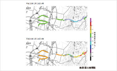
Test delivery of road frozen information etc. to road administrators
-
One example of real-time snow and ice disaster prediction under this project is joint research with private weather forecasting companies to provide snow and ice road information. A pilot scheme is currently being operated on actual roads, to examine and ascertain how information can be usefully harnessed. In recent years the Tokyo Metropolitan region has experienced heavy snow, and drivers are often stranded in their vehicles. Being able to predict the state of snow and ice on roads in advance would empower road administrators to take early action such as traffic restrictions and to avoid major congestion.