Developing Technologies to Predict Water Disasters based on Multi-sensing
Pursuing more “reliable” information to predict wind/flood and landslide disasters!
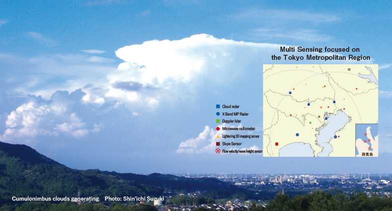
Even in the past 25 years, the number of lives lost to meteorological disasters - such as torrential rain, heavy snow and landslide disasters – has not decreased. At the front-line of disaster response, hazard information with a high degree of reliability is required. In terms of the evacuation advisories issued by municipalities to protect residents, most of them are based on actual observation, and application of prediction information is still insufficient. For example, if it were possible to predict cumulonimbus clouds developing from its start to finish, and then becoming rain, followed by torrential rain, it would be very helpful for ensuring swift evacuation and disaster response. This project leverages various kinds of cutting-edge sensing (measurement) devices, and focuses on the Tokyo Metropolitan Region where disasters can easily cascade. It also uses simulation technologies extensively. We are committed to carrying out research that provides ever more precise information to the site of a disaster, from the prediction phase all the way to grasping the circumstances after a disaster has struck.
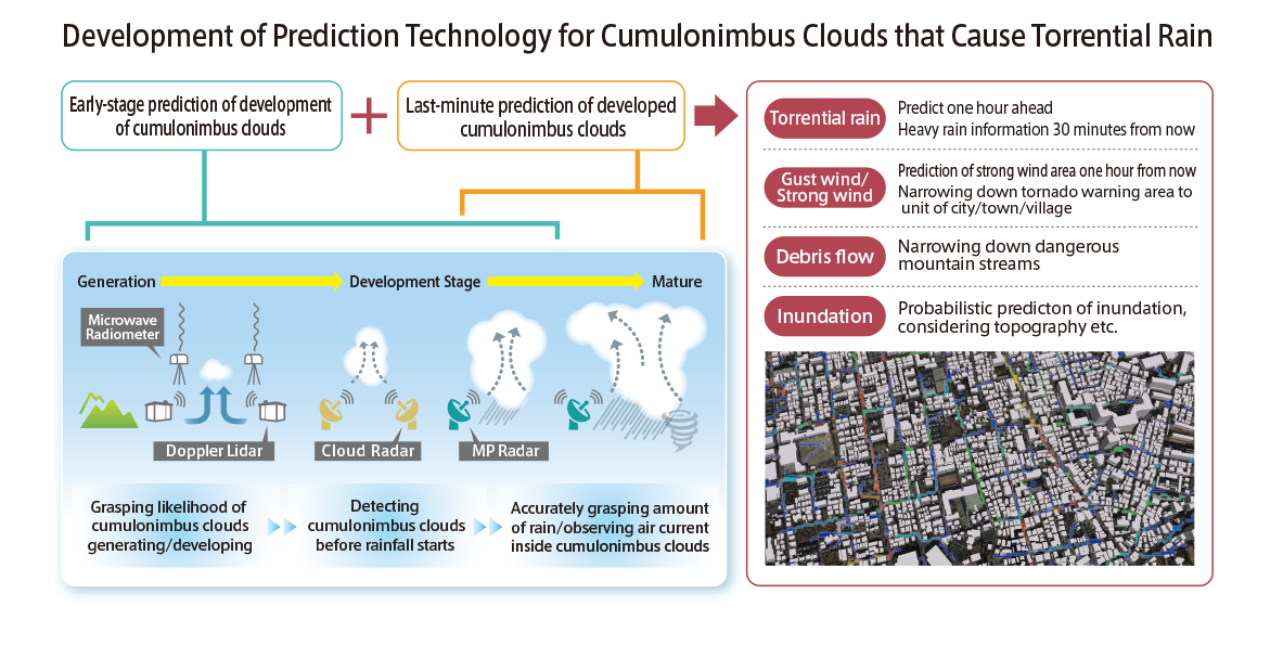
Developing prediction technologies for cumulonimbus clouds that cause torrential rain
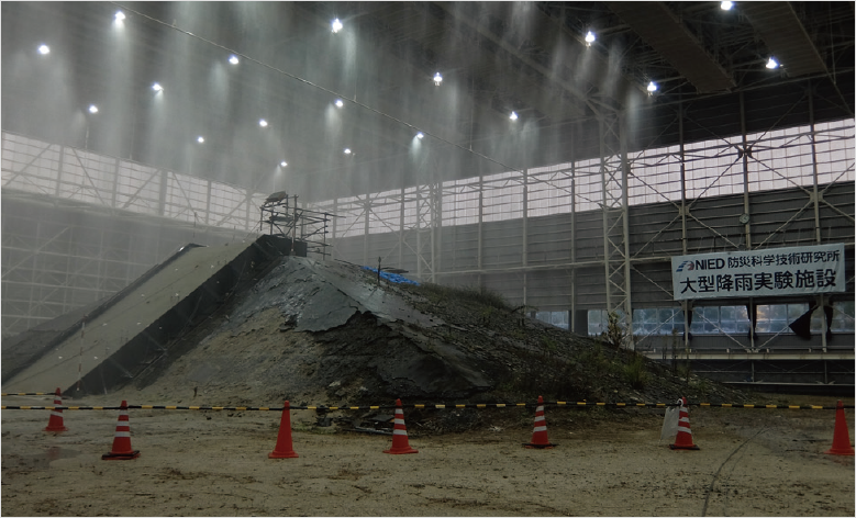
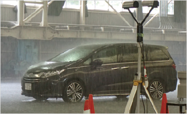
World’s largest class of Large-scale Rainfall Simulator
NIED’s Large-scale Rainfall Simulator has the world's largest rainfall simulation facility that can produce rainfall intensity up to 300 mm/hr., over a range of approx. 3000㎡.
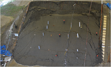
It is possible to recreate landslide caused by heavy rain and to investigate their mechanisms. Other experiments include performance verification of sensors for detecting landslides and the performance of radar and automated driving in torrential rain conditions.
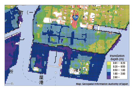
Upgrading prediction technology for coastal disasters: such as prediction of storm surge
We are promoting research that carries out storm surge/inundation simulations based on the highest class of typhoon anticipated, aiming to assist evacuation from flooding disasters caused by storm surge.
Joint Demonstration Experiments with local authorities
We conduct joint demonstration experiments with local governments to ensure that the necessary disaster resilience information is provided at the optimal timing. We also provide technology and human resource development to private companies.
-
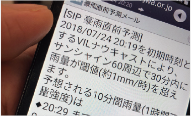
From July-October 2018, implemented a demonstration experiment for “torrential rain last minute prediction” which provides a forecast in an email notification.
-
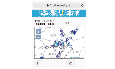
“Furu-Report” publicizes online weather reports provided by citizens (hail and snow, gusts of wind, floods etc.). Posted information is used for R&D.
TOPICSX-Band MP Radar for swift detection of drastic changes in torrential rain.
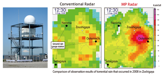
X-Band Multi-Parameter Radar is capable of observing the intensity of rain and its rainfall area with greater precision than conventional weather radar, by transmitting and receiving 2 radio waves (polarized waves) that oscillate in the vertical/horizontal direction. X-Band MP Radar observation technologies developed by NIED are used in MLIT’s XRAIN as a technology transfer, and are used countrywide for the monitoring of torrential rain. Currently, 250 units of rainfall information for all 4 directions units are provided by XRAIN every minute. Swiftly capturing drastic changes to torrential rain etc. translates into the appropriate response.